Description
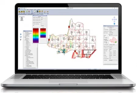
Proven survey, field design and landforming
Water management, also known as landforming, land leveling or water conservation, is optimizing field drainage to reduce input costs and maximize yield potential. As the foundation for all agricultural operations, proper water management is a core variable in the precision equation.
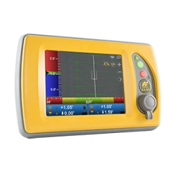
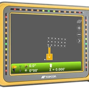
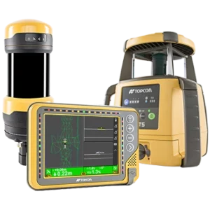
Our dependable survey, design and on-machine hardware solution includes dual constellation GNSS satellite reception for maximum accuracy, with single or dual scraper control. The GNSS system offers continuous 24/7 operation and can work in wind, dust, fog, and other environmental conditions where working with lasers is challenging.

Avis
Il n’y a pas encore d’avis.